The Great Washington State Road Trips
@Charles

Details
Details
Skagit Valley Tulip Festival
@Charles
Skagit Valley Tulips Festival 從每年四月中開始,至四月底結束。
Details
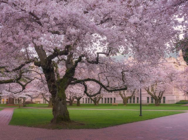
The UW Quad 🌸
@Charles
The Quad at the Unicersity of Washington: 樱花每年3月中旬前后绽放,校方通常会有通知。
Details
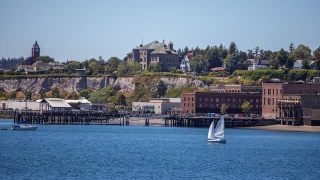
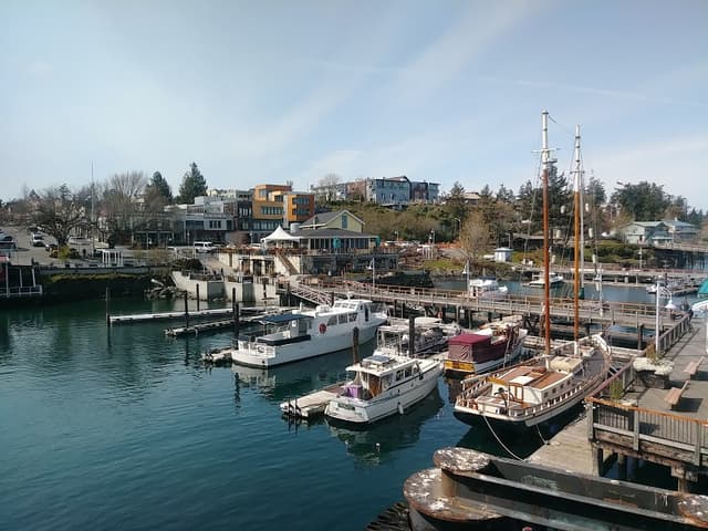
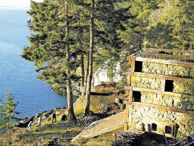
Port Townsend
@Charles
Continue north up to Port Townsend for a taste of fin de siècle charm. Explore historic Fort Worden overlooking Admiralty Inlet or tour the new čičməhán Trail, then stop at Finistère for happy hour or a dinner of fried Washington oysters. Can’t get a table at this upscale spot? Roomy Sirens Pub and its waterfront deck is a worthy back-up plan. While the indie darling Rose Theatre remains closed for the time being, the Wheel-In Motor Movie is showing classics all summer long under the stars. Spend the night at the Old Consulate Inn, a charming Victorian-style bed-and-breakfast with a view of Port Townsend Bay from the porch swing.
Details
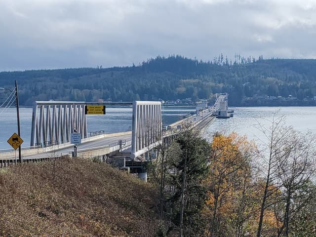
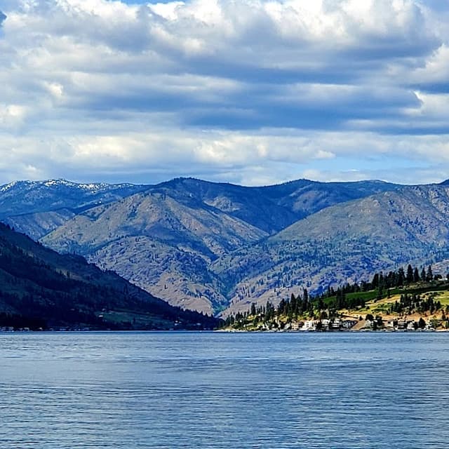
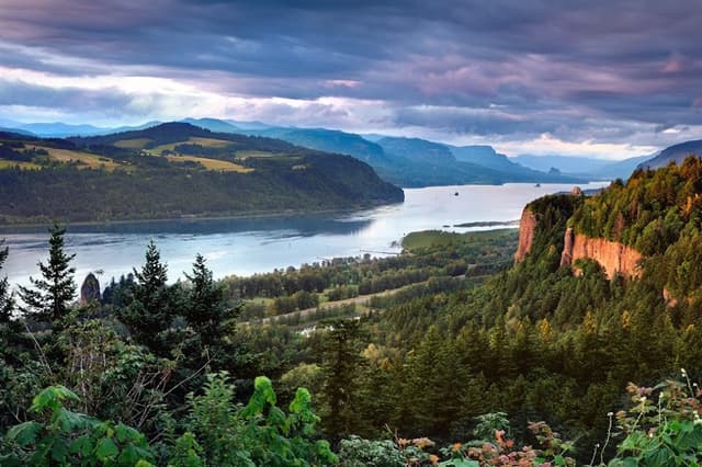
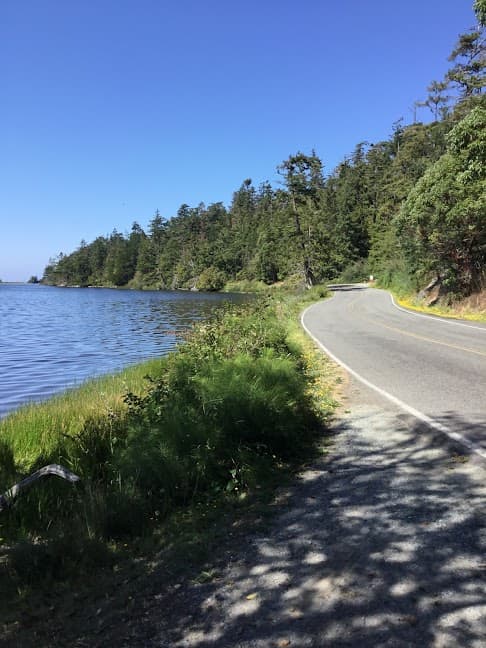
Hood Canal Floating Bridge Viewpoint
@Charles
You don’t need an Alaskan cruise to experience a fjord, just a Washington State Ferry. Go counterclockwise, starting with a ferry to Bainbridge Island and crossing the Hood Canal Floating Bridge. Pretty soon after Quilcene, you’ll be hugging the shoreline, wedged between the forested hillsides leading deep into the Olympics and the calm, glacier-carved saltwater that wends its way like a backward J.
Details
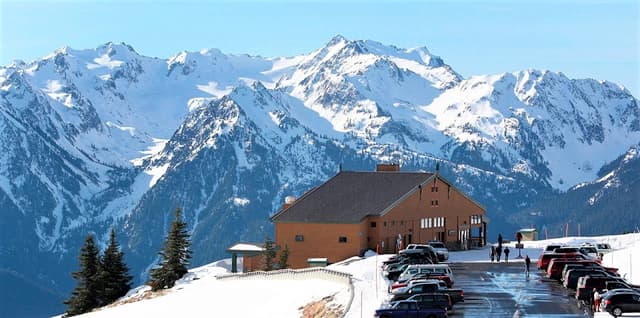
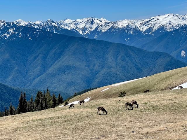
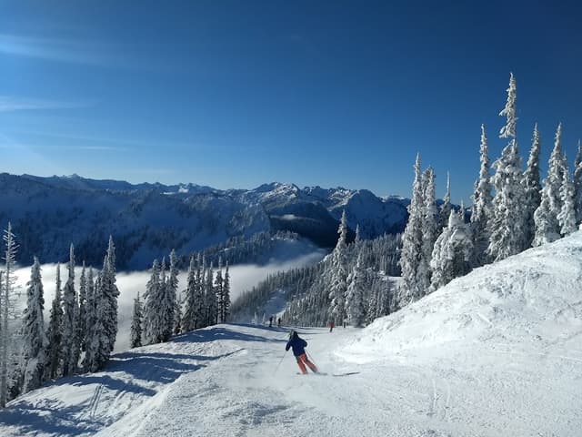
Hurricane Ridge Visitor Center
@Charles
At just under 8,000 feet, Mount Olympus is the highest point in the Olympic Mountains, whereas the volcanic peaks of the Cascades soar well beyond 14,000 feet.
Located on the western peninsula of the state, Olympic National Park is home to the Olympic Mountains and approximately 200 glaciers.
About half of its glacial area has disappeared since 1900.
More recently, the peninsula has lost 35 glaciers and 16 perennial snowfields since 1980.
Washington is the second most glaciated state in the country, with about 173 square miles of glaciers, perennial snow and other ice features.
Alaska leads the country with a breathtaking 3,474 square miles, while Wyoming comes in third with just under 29 square miles.
Details
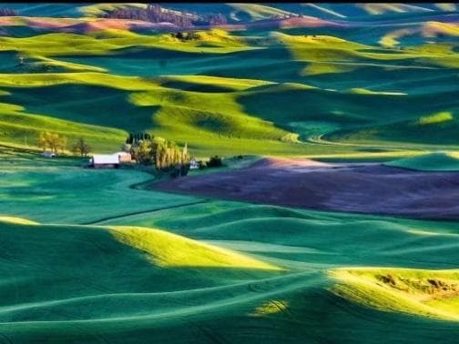
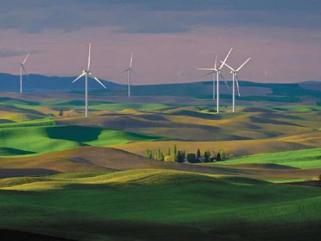
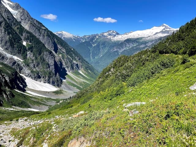
Palouse
@Charles
Palouse 地貌 — 华盛顿州被《国家地理》评为“一生必到的地方”,壮观起伏的草坂,被称为“美国的托斯卡纳”,还是Windows桌面的拍摄地。
Details
Details
Details
Details
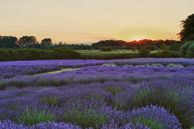
Jardin du Soleil Lavender Farm
@Charles
Sequim’s fields in fragrant bloom as Lavender Weekend approaches in mid July.
Like the flocks of summer tourists, bees are annually drawn to the fragrant fields of lavender, like this one at the Jardin du Soleil Lavender Farm in Sequim, which bills itself as "America's Provence”.
Details
Steptoe Butte State Park
@Charles
Photographer: Russ Stamp
Photo taken: May 31, 2022, at Steptoe Butte.
Photographer's description: "Made the trip to Eastern Washington from our home on the Olympic Peninsula. After researching different areas of the Palouse to photograph, I knew one of the places I wanted to photograph was Steptoe Butte. After spending most of the late afternoon on top of the butte with mostly flat light, we began to make our way down the road when this light happened. So thankful to witness light like this, considering we were only there a few days. Shot with a Fuji X-T2 and 55-200 mm lens."
Critique: "The Palouse in the spring is one of my favorite.”
Details
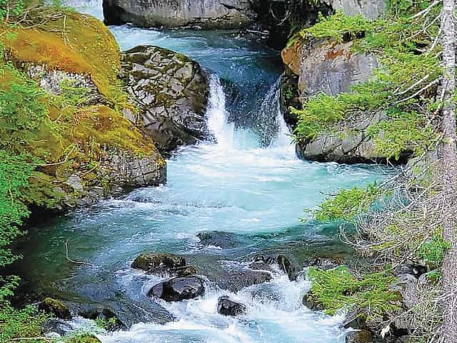
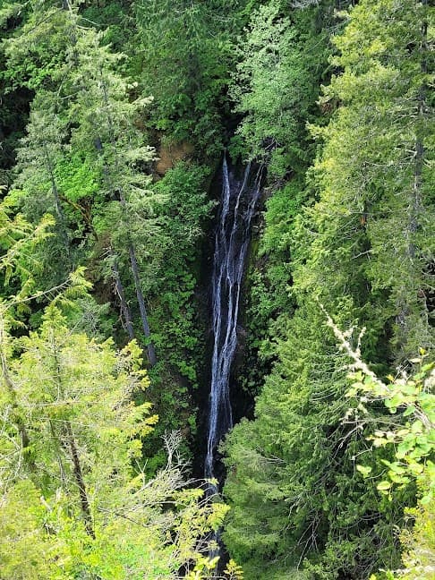
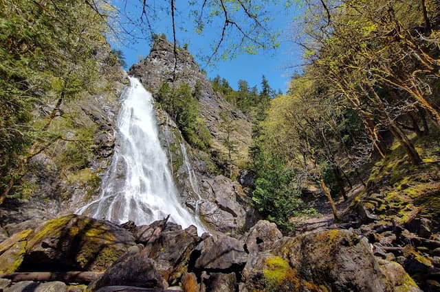
Hamma Hamma Falls
@Charles
Photographer: Nathan Berg
Photo taken: June 19, 2022, at Hamma Hamma Falls
Photographer’s description: “It was a typical late spring day in the Olympic Mountains. As with many Washingtonians, my girlfriend and I do not wait for good weather to embark on an adventure. Kelly Bayne and I packed up the dualsport motorcycles and hit the soggy dirt roads. After a few hours of heavy rainfall, we decided to ride up the mountain. To our amazement, we found ourselves above the clouds in the warm sun and above the beautiful Hamma Hamma Falls.”
Critique: “This is gorgeous. You lucked out on your timing, as the lighting here is just superb for the picture. There is so much to see here, and all of it is beautiful!
The color of the water slices right through the forest as it zigs and zags its way down the mountain. The composition is excellent, as well — interesting from top to bottom. I have nothing particularly insightful to say about this image besides, ‘Wow’ — and, of course, thanks for sharing.”
Details
Details
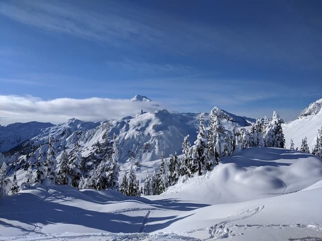
Artist Point
@Charles
Due to the long snow season, there is a short summer window to visit the Artist Point. Those using assistive devices should take caution of any lingering ice or other slippery surfaces. Check recent trip reports or call the Mount Baker Ranger Station in Glacier for current conditions.
Details
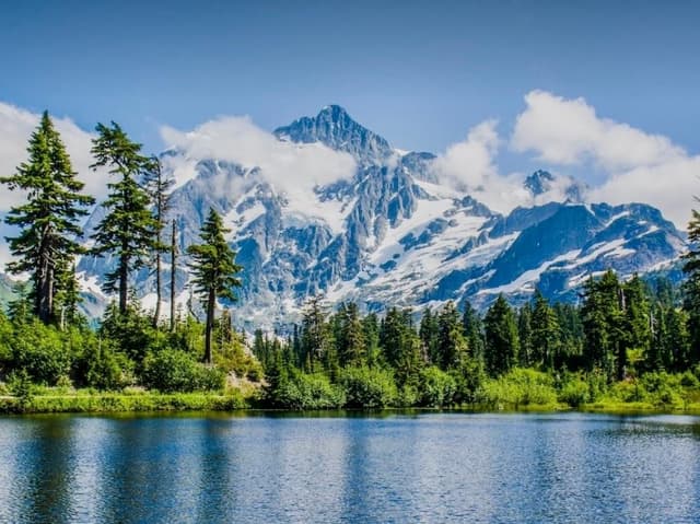
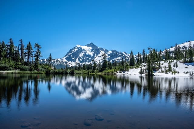
Picture Lake
@Charles
The short, ADA-accessible path around Picture Lake near Mount Baker is one of the most photographed views in the United States. The view of Mount Shuksan is among the most beautiful sights in all the North Cascades and is well worth the drive to see with your own eyes.
Details
Artist Point
@Charles
Due to the long snow season, there is a short summer window to visit the Artist Point. Those using assistive devices should take caution of any lingering ice or other slippery surfaces. Check recent trip reports or call the Mount Baker Ranger Station in Glacier for current conditions.
Details
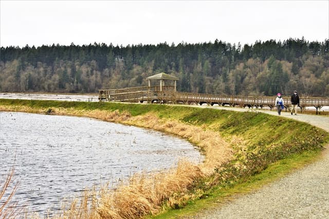
Billy Frank Jr. Nisqually National Wildlife Refuge
@Charles
Named in honor of the Nisqually tribal member who fought for Native American fishing rights and was essential to the protection of this wildlife preserve, the Billy Frank Jr. Nisqually Wildlife Refuge offers several miles of accessible trails consisting of gravel paths and wooden boardwalks. The refuge, located right off Interstate 5 just north of Olympia, is teeming with native plants and wildlife, including a diversity of fish, birds and marine animals.
Details
Discovery Park
@Charles
Seattle’s largest park has plenty to explore for hikers with assistive devices. Various viewpoints offer the chance to see shoreline birds, seals, otters and more. Anyone with children under 5 or a mobility issue of any kind can stop in at the visitor center to pick up a permit that gives access to Discovery Park Boulevard, which leads right to the beach. The North Beach Trail is partially wheel-friendly, and depending on fitness level, hikers can head back up Discovery Park Boulevard on a sidewalk.
Details
Gold Creek Pond
@Charles
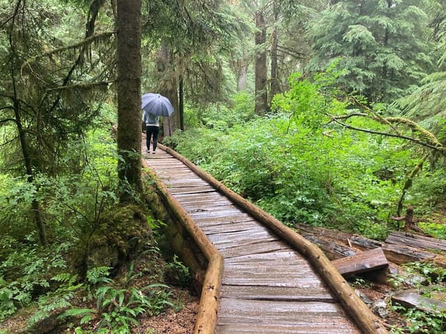
ADA-accessible outside of the winter months, Gold Creek Pond follows a 1-mile path around the lake that is lined with wildflowers before reaching a boardwalk that hovers over a marsh. At the end of the boardwalk, a paved path leads to the shores of the clear blue pond. Bring a lunch to enjoy at the picnic area a short distance from the shore.
Details
Iron Goat Trail
@Charles
Hike along the old Great Northern Railroad that once took trains up into the Cascade Range. The first 3 miles of this trail are ADA-accessible on the lower route. The wide gravel trail that starts from Martin Creek includes bridges over stream crossings. Be sure to stop and read the interpretive signs that inform hikers about a devastating avalanche and of the people who built the railway, mainly Japanese immigrants.
Details
Padilla Bay Trailhead
@Charles
This all-seasons hike follows Padilla Bay, a Puget Sound estuary at the edge of the Skagit River Delta. The 8,000-acre eelgrass meadow is one of the largest in North America and is an important habitat for aquatic life, birds and sea mammals. The flat gravel path follows the estuary for 2.1 miles and features views of Lummi Island and a peekaboo view of Mount Baker.
Details
Seward Park
@Charles
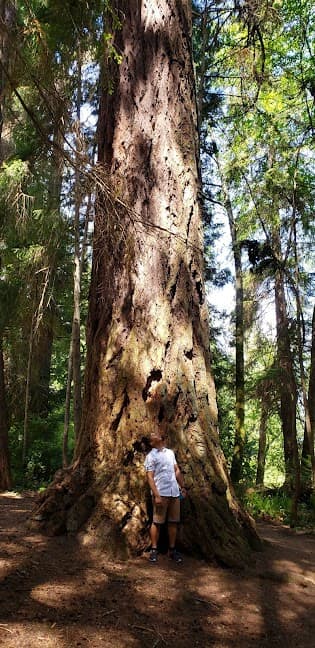
Seward Park offers a number of wheel-friendly trails. The 2.6-mile Perimeter Loop Trail hugs the shoreline and features a direct view of Mount Rainier. The Sqebeqsed Trail is a less-frequented, 1.2-mile out-and-back that travels among some of the oldest trees in the Seattle area.
Details
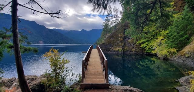
Devil's Punchbowl on Spruce Railroad Trail
@Charles
Originally used to haul Sitka spruce trees out from the forest, the Spruce Railroad starts in an orchard before opening to a dense forest and views of glimmering Crescent Lake. Hikers who are able to walk with an assistive device can aim for Devil’s Punchbowl, a deep blue pool of still water. The start from the Crescent Lake parking lot has a bit of an incline, so wheeled hikers may need a push assist or motorized wheelchair to navigate.
Details
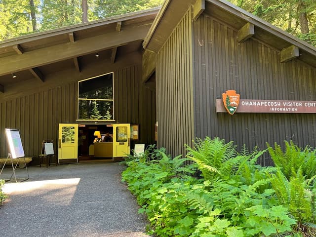
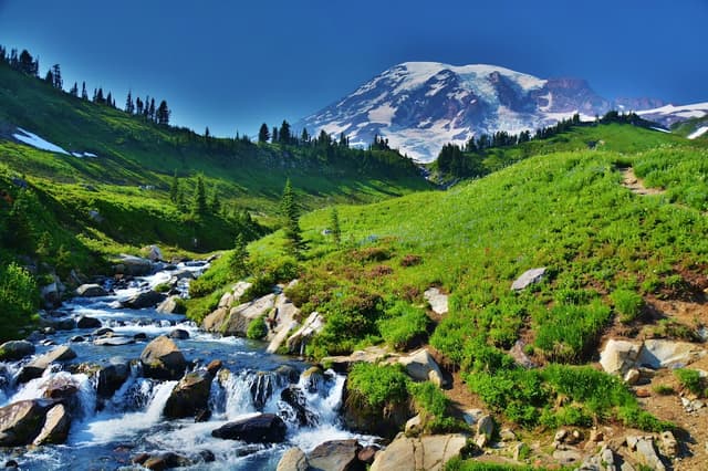
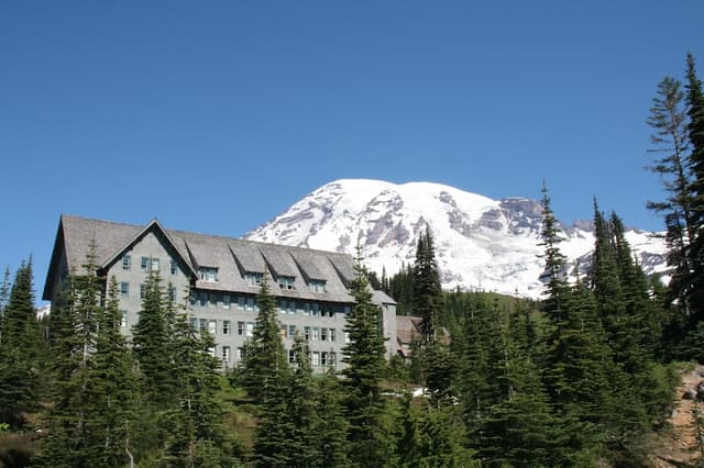
Mount Rainier National Park
Details
Details
Details
Details
Details
Details
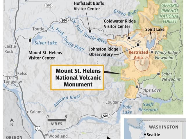
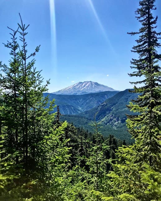
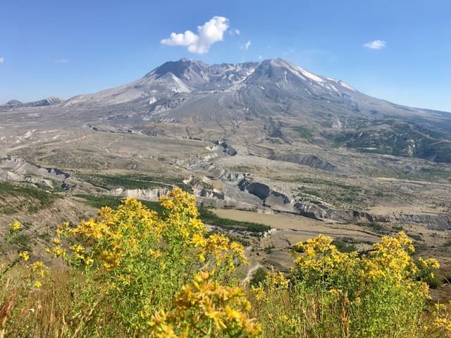
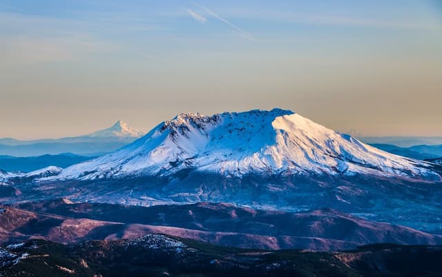
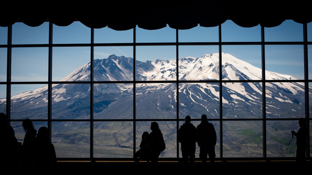
Mount Saint Helens
@Charles
May 18 marks the anniversary of 1980 eruption of Mt St Helens
Details
Gifford Pinchot National Forest
@Charles
As I turned off Interstate 5 onto the Spirit Lake Highway, I saw that the businesses serving tourists that opened after the creation of the monument are long gone. In the 1980s, more than a million people visited the Gifford Pinchot National Forest every year, pumping hundreds of millions of dollars into the local economy. By 2006, visitation to the monument fell to only about 700,000 visitors, and businesses began to fail. By 2016, visitation had crashed to about 180,000 — barely a quarter of what it was a decade before. Recreational use of Mount St. Helens today is less than it was in the years before the eruption
Details
Coldwater Ridge Visitor Center
@Charles
The $11.5 million Coldwater Ridge Visitor Center opened with fanfare in 1993. I drove to the Coldwater Ridge Visitor Center, which closed in 2007 due to lack of funding just 14 years after it opened. The nonprofit Mount St. Helens Institute has been valiantly laboring to maintain the building and recently signed a 30- year lease with the Forest Service to convert it into an outdoor learning center, but the institute knows that it will need to look beyond the Forest Service to fund its plans.
Details
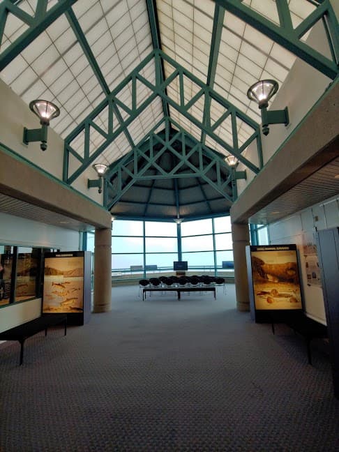
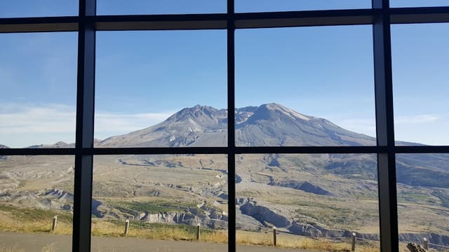
Johnston Ridge Observatory
@Charles
David Johnston Observatory, named after the U.S. Geological Survey scientist who was killed while monitoring the volcano, opened in 1996. The Johnston Ridge Observatory does not have any food facilities, and the nearest camping is miles away and outside of the monument, so visitation to the facility has always been less than was expected.
Details
Mount St. Helens National Volcanic Monument
@Charles
As I hiked into the monument, I discovered that trails are decaying to the point of being unsafe because of lack of maintenance. Today, much of the trail maintenance is being done by volunteers rather than the Forest Service. Culverts are clogged with debris. Interpretive signs are barely legible or missing. Much of what was built is rotting and rusting away. Human-created infrastructure does not renew itself; it must be cared for.
Details
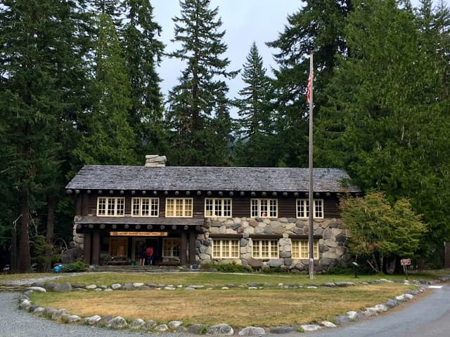
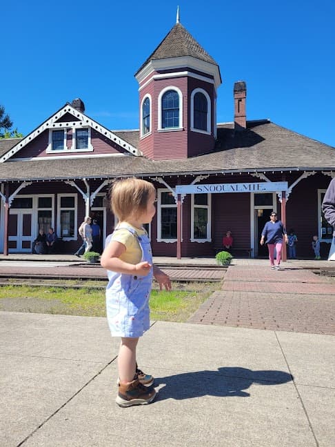
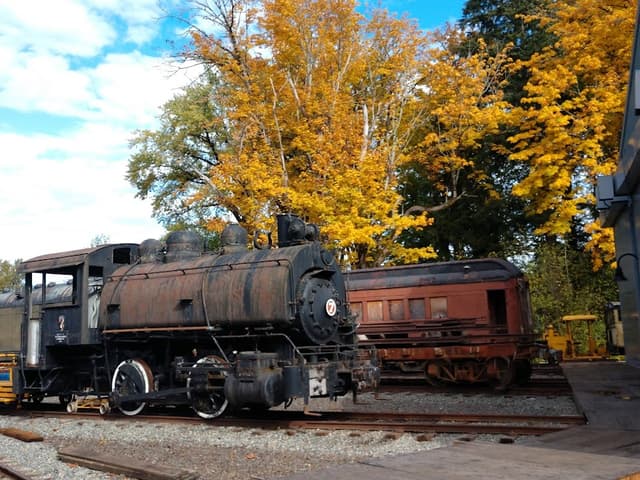
Snoqualmie Depot
@Charles
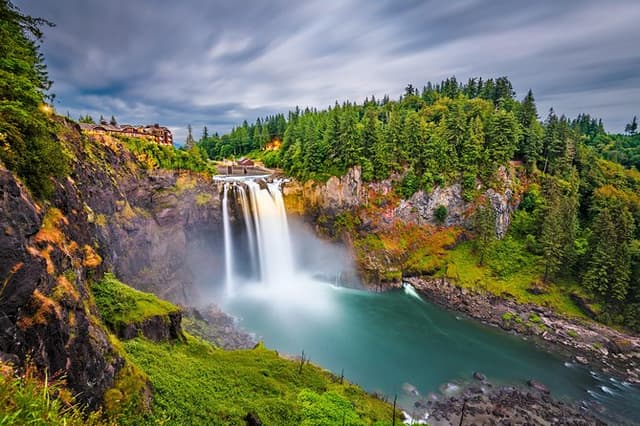
Enjoy a steam train ride through the scenic upper Snoqualmie Valley! Begin your 2-hour, round trip experience in North Bend when you climb aboard historic passenger cars and journey west to the Snoqualmie Depot. After a brief stop to pick up passengers, continue travelling west to the top of Snoqualmie Falls, pausing at the crest for a view of the lower river valley. Return east to the Railway History Center (RHC) for a 30-minute stopover to visit the Train Shed Exhibit Hall. Then hop back aboard and return to the North Bend Depot.
Details
Details
Details
Northwest Railway Museum, North Bend Depot
@Charles
Details
State Parks in WA
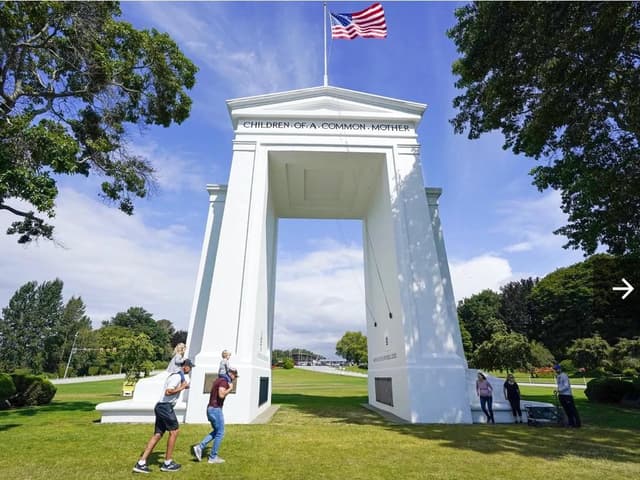
Peace Arch Historical State Park
@Charles
“May These Gates Never Be Closed” reads one of the inscriptions on the Peace Arch, a 101-year-old landmark along the westernmost point of the U.S.-Canada border. Sadly, they did close to nonessential travel for over 16 months, dealing a serious blow to our region’s shared identity as Cascadia. But for those eager to rekindle cross-border connections, the Peace Arch once again welcomes the “Children of a Common Mother” (another inscription) from both sides of the 49th parallel that separates the two countries. While many glimpse the arch from a car window while crossing the border, the arch anchors a unique state park that’s also a British Columbia provincial park. Visitors are allowed to travel freely within the park’s boundaries as long as they return to the country from where they arrived. Why stop and stretch your legs? To explore 40 acres of gardens, home to over 200 perennials and 20,000 annuals, as well as lovely views of Semiahmoo Bay and the islands beyond. Don’t miss the annual summer sculpture exhibition.
Details
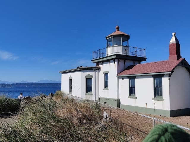
Lime Kiln Point State Park
@Charles
For whale watching without the expense and environmental impact of a motorized boat tour, pitch up with your binoculars at Lime Kiln Point State Park on the west side of San Juan Island. Gray, humpback, minke and, yes, orca whales are all known to frequent these waters from spring through fall. Rocky trails hug the cliffs where you can pick out your favorite viewing spot. Check in at the Lime Kiln Interpretive Center for the latest whale sighting reports before you head down to the water’s edge. If whales prove elusive, the park’s 103-year-old lighthouse is guaranteed to be on display.
Details
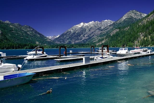
Sequim Bay State Park
@Charles
Want to maximize your odds of dry weather after our soaker of a winter and spring? This corner of the Olympic Peninsula sits in an exceptional rain shadow, making for one of the driest climates in Western Washington. Trips to Sequim usually entail lavender farms and walks out Dungeness Spit, but this state park tucked into a pleasant bay shouldn’t be overlooked. It provides access to the Olympic Discovery Trail, a multiuse recreation trail that stretches 120 miles from Port Townsend to the Pacific, and a plethora of moorage for boaters. The Ramblewood Retreat Center is also located here if you are planning an event with a large group.
Details
Fort Flagler Historical State Park
@Charles
The “Triangle of Fire” once guarded the entrance to Puget Sound at Admiralty Inlet with a trio of forts that ensured no enemy naval vessel could slip past. All three forts — Worden, Casey and Flagler — are now state parks. Of the three, Fort Flagler on Marrowstone Island is the most out of the way, and thus the quietest. Military buffs will delight at the gun emplacements stationed along the Bluff Trail, while beachcombers can enjoy a long sandy walk, especially at low tide, below the bluff. The Beachcomber Cafe has seaside essentials like ice and beach toys, as well as burgers, sandwiches and coffee. The cafe is popular with campers who can set up near the water’s edge. Olympic Kayak Tours offers guided paddles through the scenic waters of Admiralty Inlet.
Details
Details
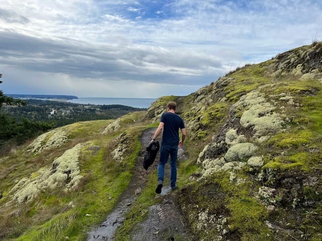
Mount Pilchuck
@Charles
North of Seattle, Jonny went with his friend while he was in Seattle.
Details
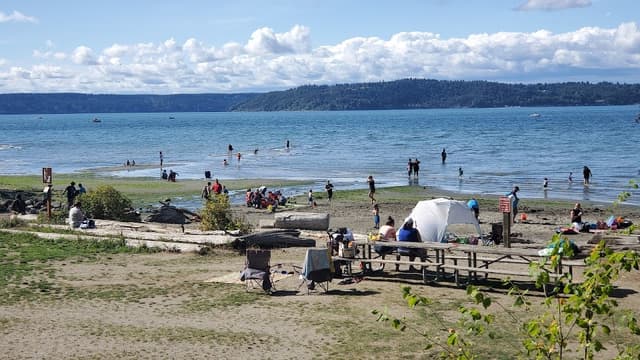
Dash Point State Park
@Charles
Dash Point hides in plain sight, straddling King and Pierce Counties on Puget Sound. An easy jaunt from Seattle or Tacoma, the park offers prized waterfront access in the most heavily populated corner of the state. There’s an ample 3,300 feet of beachfront with views of Vashon Island. Skimboarders in particular take advantage of the low tide shallows to zip along in just a few inches of water above the sand. If you need a break from the beach, there are 11 miles of forested trails in the upland portion of the park. With 114 campsites, Dash Point makes for an ideal close-to-home camping destination.
Details
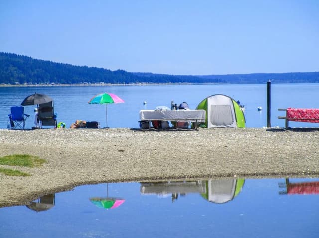
Twanoh State Park
@Charles
Warm saltwater is a precious commodity in the Pacific Northwest. At Twanoh State Park on Hood Canal, the summer sun does the work to heat up the shallow waters. Locals have known this tip for a long while: Twanoh became a state park in 1923. With such an old vintage, the park is also a treat for architecture buffs who are fans of the rustic style of park shelters built by the Civilian Conservation Corps in the 1930s. When the tide recedes, oysters are there for the plucking and shucking — make sure you have a valid shellfish license. If you’re feeling sunbaked, the park also creeps up the hillside to the south with a gentle hiking trail through a mossy forest and along a salmon-bearing creek.
Details
Details
Columbia Crest Winery
@Charles
Columbia Valley: Washington’s Biggest Wine Region
Details
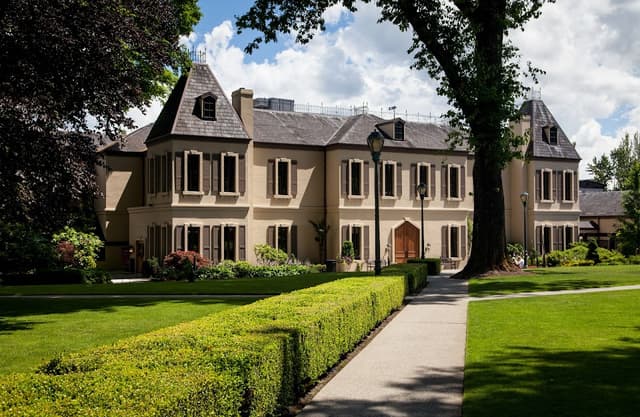
Chateau Ste. Michelle Winery
@Charles
Change could be coming to one
of Washington's most prominent
wineries Chateau Ste. Michelle. It is considering selling its vast Woodinville
property home to the winery's
tasting room, banquet rooms and
summer concert space - as it
consolidates wine production east
of the Cascades.
Details
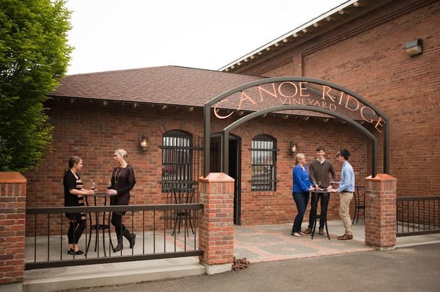
Canoe Ridge Vineyard Tasting Room
@Charles
Details
Shoulder Season Hiking
The ‘Little Loop’ Around Hood Canal
For Seattleites, a trip on the ferry and a short jaunt past Poulsbo get you to the Hood Canal Bridge. With breathtaking scenery, plenty of curves to practice, bars, oysters, a 230-foot horsetail waterfall, a 100-year-old farm stand and easy access to hikes and longer rides, the Hood Canal Loop has something for just about everyone. The circle can be done in under three hours or up to seven with a fair number of stops. You can start anywhere in the loop, but many seasoned riders like to go counterclockwise starting at the Hood Canal Bridge. That way, the most scenic views, and the ice cream, come at the end of the trip — like an extra reward. And more importantly, you are not dealing with eastbound traffic over the Hood Canal Bridge, which on weekends is something to avoid at almost all costs.
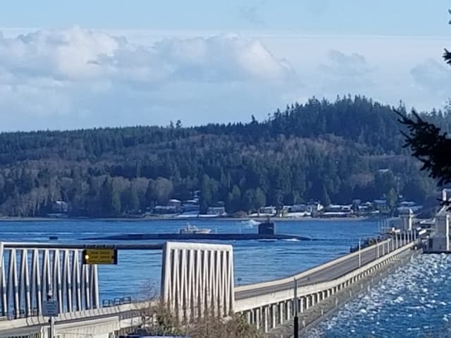
Hood Canal Floating Bridge
@Charles
At 7,869 feet, the Hood Canal Bridge is the longest floating bridge in the world located in a saltwater tidal basin, and the third longest floating bridge overall. First opened in 1961, it was the second concrete floating bridge constructed in Washington.
Details
Details
Details
Geoduck Restaurant and lounge
@Charles
Veterans of the route will tell you a stop at the Geoduck Restaurant & Lounge in Brinnon is a vital part of the trip. The local favorite has fried oysters and chowder that aficionados rave over. You are likely to see a row of motorcycles parked outside all summer, as it is a perfect stop midway around the loop.
Details
Hama Hama Oyster Saloon
@Charles
Stop and eat fresh oysters that were harvested less than a few hundred yards away, or buy some fresh oysters to take home.
Our food writers have recommended the roasted oysters in chipotle bourbon butter with toasted baguette, raw oysters on the half shell or trying to shuck yourself for a DIY experience.
If you want to eat at the outdoor waterside site, try to get there before 1 p.m. on the weekends, hospitality manager Jinelle Kubly suggests.
“It can be really hard to get a spot on Saturday and Sunday afternoon,” she said. She recommends Friday or, better yet, go on Monday.
Details
Hoodsport
@Charles
Hoodsport is a good place to stop and stretch your legs. The small town has close to a dozen little shops, eateries and a distillery. It’s also the entry to Lake Cushman and the Staircase hikes, so this part of the route can be crowded.
Details
Details
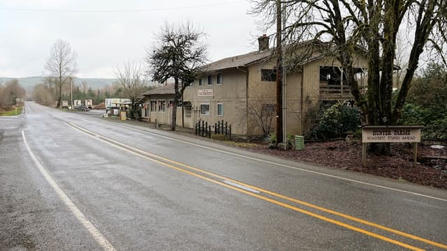
Hunter Farms
@Charles
Stop for ice cream at the 100-year-old family-run Hunter Farms, where you can also get loads of fresh produce in the summer. The farm offers hay rides and pumpkin picking in the fall.
Details
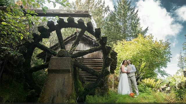
Dalby Water Wheel
@Charles
On your way back toward Kitsap County, keep your eyes peeled for the easy-to-miss Dalby Water Wheel. The wheel was originally part of a cable car system in Seattle and was brought to the waterside town of Union by Ed and Ethel Dalby in 1924. The wheel generated enough electricity to power their home and several cabins until the 1940s.
Details
5 scenic, winding Washington routes worth riding
With the range of scenery from the Pacific Coast, the Olympic Peninsula, the Cascade Mountains, the Columbia River basin and the rolling hills of Eastern Washington, the Evergreen State has some of the best rides in the whole country.
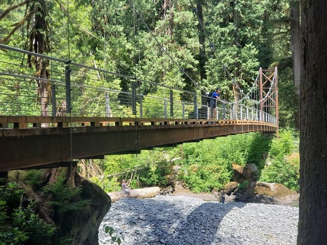
Highway 101 Loop
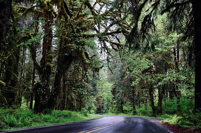
Hoh Rainforest - Olympic National Park
@Charles
Details
Details
Two- or three-day trip — 360 miles.
The Highway 101 Loop circles the Olympic Peninsula and covers more than 360 miles around over a million acres of crystal-clear lakes, the sacred Hoh Rain Forest and charming little towns.
Most recommend taking at least two days for this trip, and three days if you want to see a lot, including an 18-mile detour up Hurricane Ridge Road, where tight, winding curves take riders to an unparalleled view of the Olympic Mountain Range.
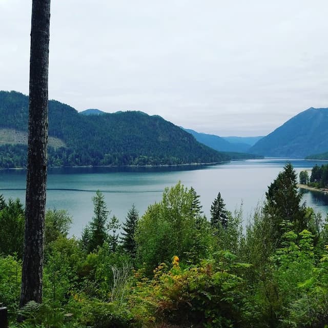
Cascade Loop
Details
Details
Details
North Cascades Lodge at Stehekin
@Charles
Details
Two- or three-day trip — 444 miles
The Cascade Loop features lush forests, orchards, vineyards, mountain peaks, valleys, deserts, waterfalls and island communities.
This trip is longer than most listed here, but definitely worth it. You will want to split this trip into at least two or three days. Start along Interstate 5 North in Seattle to Mukilteo, then take Highway 2 east toward Wenatchee. On the way, soak in the incredible views of Stevens Pass. Next, head to Leavenworth, Wenatchee, Lake Chelan and North Cascades National Park.
Mount Rainier Loop
One-day trip — 221 miles
If you’re looking for great views and twisty roads, the Mount Rainier day ride is the perfect one-day trip, at 221 miles. Locals suggest starting in Enumclaw, about 43 miles and 1.5 hours east of Seattle. To get there from Seattle, take I-5 South then WA-164 East. From Enumclaw, take Highway 410 to arrive at the Chinook pass, where you’ll experience an incredible view.
Once you’re finished there, go back and take Highway 123 south to the Stevens Canyon entrance to Mount Rainier National Park. You will wind around the Ohanapecosh River and up Stevens Canyon Road, experiencing some exciting and sharp switchbacks with grand views. As you near the top of the road, take time to stop and soak in the scenery.
Highway 14
Columbia River Gorge National Scenic Area
@Charles
Details
Details
One- or two-day trip — 221 miles
Highway 14 takes riders along the north side of the stunning Columbia River Gorge. Start in Vancouver, Washington, and take the highway east to Goldendale. Along the way, you’ll experience an incredible change from forest to desert as you travel through the beautiful basalt canyon. The route is about 120 miles one way. Take a detour left onto Highway 141 after Stevenson to get a great view of the volcanic Mount Adams, the second highest peak in Washington.
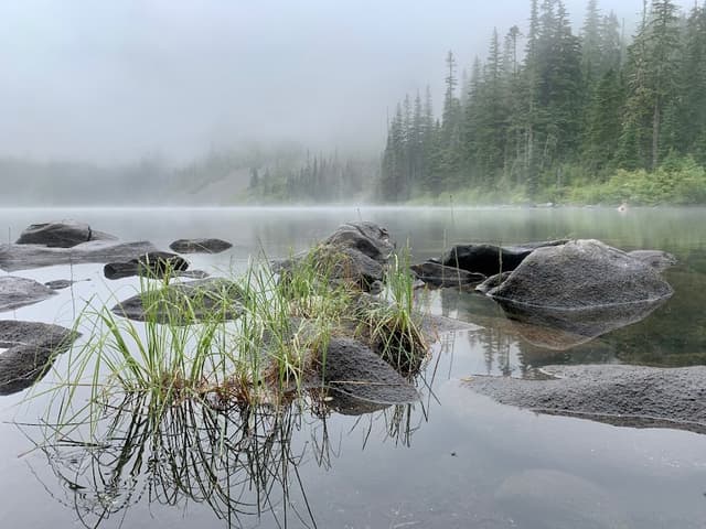
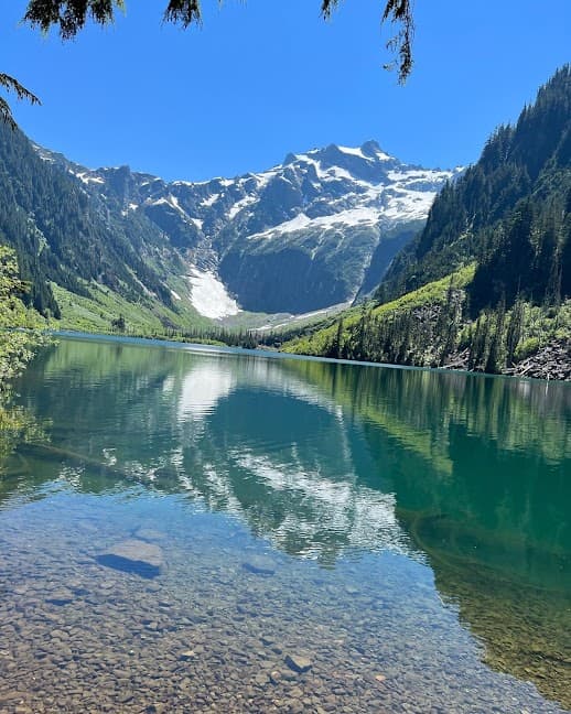
Lakes in the State of Washington
Snow, Spurce and Annette lakes are closed in summer of 2022. Here are 6 other worthwhile hikes to lakes
Granite Lakes
@Charles
Granite Creek Trailhead, NF-5600, North Bend.
The Middle Fork Snoqualmie is a veritable hiker’s buffet, with a multitude of options accessed by a paved road and spacious trailheads — not that they don’t fill up on busy days. Try the Granite Creek Trailhead, the next right-hand-side trailhead farther up the road from immensely popular Mailbox Peak, for an 8.8-mile round-trip hike to Granite Lakes. Camping is not permitted here, but if you push 2.1 more miles to Thompson Lake, you’ll be in the Alpine Lakes Wilderness, where you can pitch a tent.
Note this hike starts on Washington Department of Natural Resources land, so you need a state Discover Pass ($30 annually) rather than the federal public lands passes described above.
Details
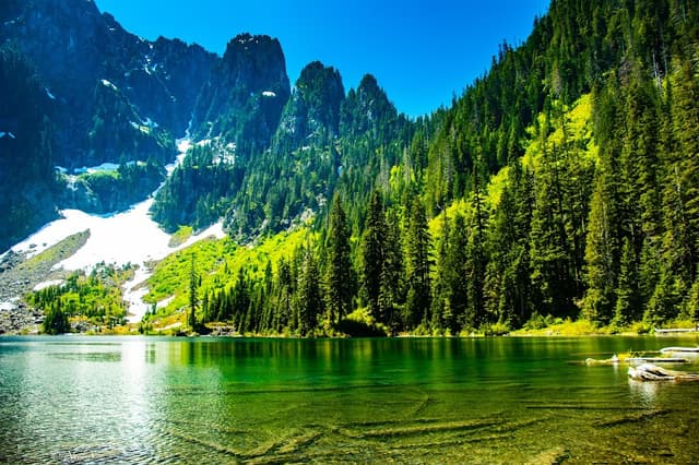
Hyas Lake
@Charles
Tucquala Meadows Trailhead, NF-4330, Ronald, Kittitas County.
Follow Cle Elum Lake deep into the Wenatchee National Forest along Forest Road 4330 until it dead-ends at the Tucquala Meadows Trailhead. While the unpaved section of the road is quite long, it is generally well maintained. At the end of the road, you’ll find horse trailers, backcountry anglers and mountain climbers. Your destination, however, is a flat, easy 4 miles round trip to Hyas Lake. There are bountiful berries along the way, ample picnic and camping spots, and striking views of Cathedral Rock and Mount Daniel, King County’s tallest peak, if you venture to the upper lake.
Details
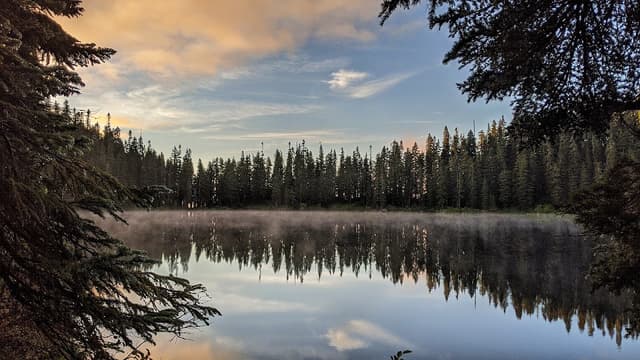
Mirror Lake
@Charles
Mirror Lake Trailhead, NF-5480, Snoqualmie Pass, Kittitas County
South of I-90 in the Snoqualmie Pass region, follow Forest Road 5480 to the Mirror Lake Trailhead west of Keechelus Lake. Park at the first lot unless you have a truly high-clearance vehicle, and even then you only save a half-mile. It’s 2.2 miles round trip to charming Mirror Lake near the Pacific Crest Trail. Halfway in, a spur trail takes you right to smaller Cottonwood Lake. Both are ideal swimming holes on a hot summer day.
Details
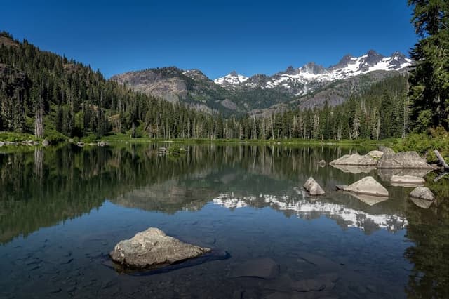
Pete Lake
@Charles
Pete Lake Trailhead, NF-113, Cle Elum, Kittitas County
Truth be told, you don’t even need to lace up your hiking boots to enjoy a spectacular lake on this excursion. The trail to Pete Lake begins at the Owhi Campground, home to Cooper Lake, a nonmotorized gem free from noisy boat traffic. But if you came all this way — along sometimes rough forest roads — you might as well meander the 9 miles out and back to Pete Lake, with a gradual 400 feet of elevation gain. Both Pete and Cooper lakes offer commanding views of snowcapped peaks. Kick back and enjoy the show.
Details
Pratt Lake
@Charles
Granite Mountain Trailhead, NF-9034, North Bend
Amid all the trail and road work in Snoqualmie Pass this summer, one just-off-the-highway trailhead has no planned closures: I-90 Exit 47, where the Granite Mountain Trailhead beckons less than a mile from the interstate. You’ll share the trailhead with peakbaggers heading up to the summit fire lookout on Granite, but the trail to Pratt Lake forks left early on.
If you’re looking for a shorter lake jaunt, this trail is also a backdoor approach to Olallie Lake, as a spur trail 3 miles into the hike leads that direction. But if you stick it out, the route to Pratt offers Rainier views along an 11-mile round-trip trek with 2,300 feet of vertical gain. The basin makes for a great backcountry camping destination.
Details
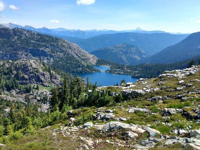
Spectacle Lake
@Charles
If you are itching to make your backcountry camp lakeside, you could do much worse than Spectacle Lake, an absolute stunner at the base of the jagged Chikamin Ridge. But the price of admission is high: 11 miles one way from the Owhi Campground. While the trail only gains 1,500 vertical feet over that distance, some stretches of trail are rough, and crossing Lemah Creek can be formidable. Make way for thru-hikers on this remote stretch of the Pacific Crest Trail, then carefully pick your way down the rooty spur trail to the lake. An isthmus juts out into the water, dotted with prime campsites.
Details
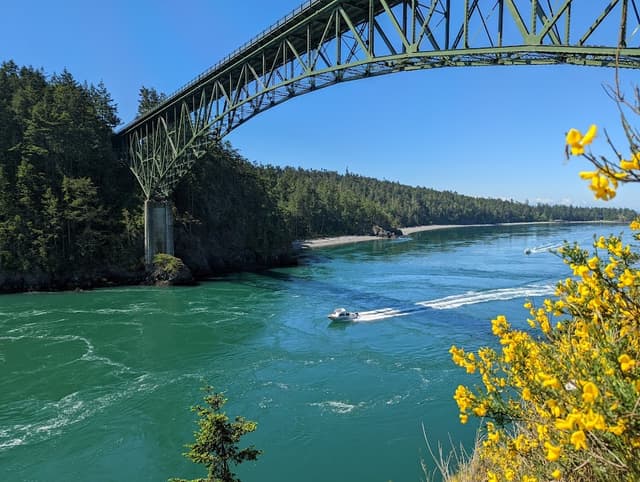
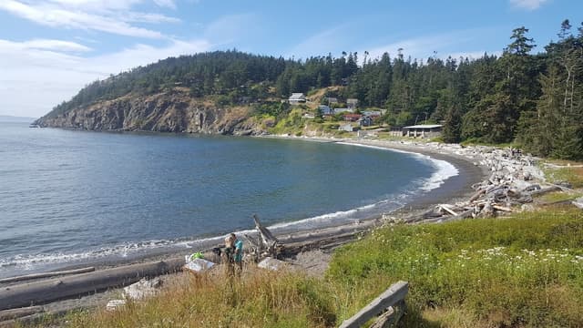
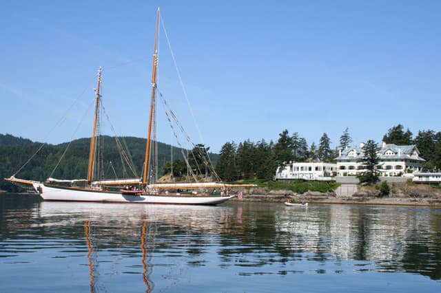
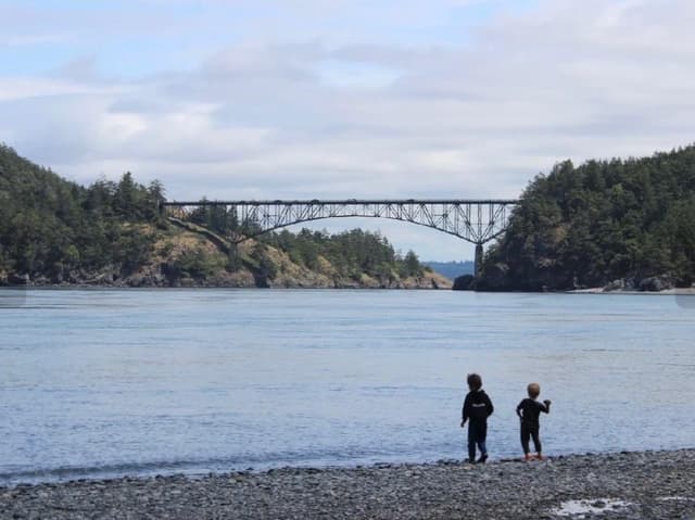
Century-Old Deception Pass
Details
Details
Details
Details
Details
Details
All National Parks that charge a fee will be free to enter certain time of the year
In honor of the anniversary of the Great American Outdoors Act, all National Parks that charge a fee will offer free admission On Aug 4th, 2022.
That includes Washington state’s three big ones: North Cascades National Park, Olympic National Park and Mount Rainier National Park.
Throughout the country, several small historic sites overseen by the National Park Service will also be free to enter Thursday. In Washington, the Fort Vancouver National Historic Site will waive its entrance fee to the reconstructed fort site.
The Klondike Gold Rush National Historical Park in downtown Seattle (which is more of a museum about Seattle’s history than a true park), the Bainbridge Island Japanese American Exclusion Memorial and the San Juan Island National Historical Park at the southern tip of San Juan Island are all free to enter daily.
Other dates in the year that are free to enter in the year:
Sep. 24: National Public Lands Day.
Nov. 11: Veterans Day.
For more information, visit the National Park Service website at www.nps.gov.
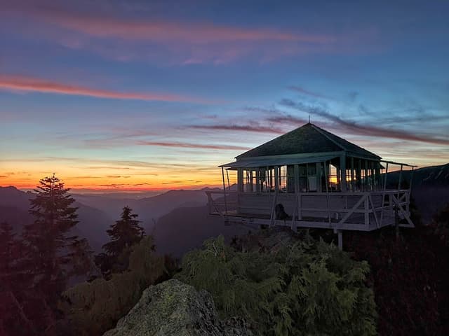
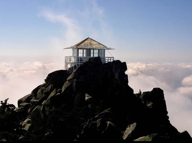
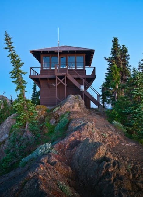
8 Hikes to Washington Fire Lookout Towers
MOUNT BAKER
Park Butte Lookout
@Charles
Pacific Northwest Trailhead, FS-13, Concrete
Park Butte is about as close as you can get to summiting Mount Baker without actually standing on its peak. This fire lookout sits atop a rock face right in the shadow of Koma Kulshan. The well-maintained, 7.5-mile out-and-back hike gains 2,220 feet of elevation and features unobstructed views of Baker, alpine meadows and rushing rivers. If you look closely from the top, you may even be able to spot mountaineers making their way toward the mountain’s summit.
Details
Winchester Mountain Lookout
@Charles
Twin Lakes Trailhead, NF-3065, Glacier
Practically a stone’s throw from the Canadian border (check your phone to see if you connect to Canadian service!), Winchester Mountain is well worth the bumpy ride to the Twin Lakes Trailhead. At 3.4 miles and 1,300 feet of elevation gain, the short hike will leave your jaw on the floor with every step, surrounded by lush meadows and Cascade peaks on all sides. The fire tower is first come, first served for sleeping, but if it’s taken, there are plenty of other sweet camping spots at the top. The road to the trailhead is steep and gnarly, and it accommodates just one car in some spots. At minimum, all-wheel drive and high clearance is required.
Details
STEVENS PASS
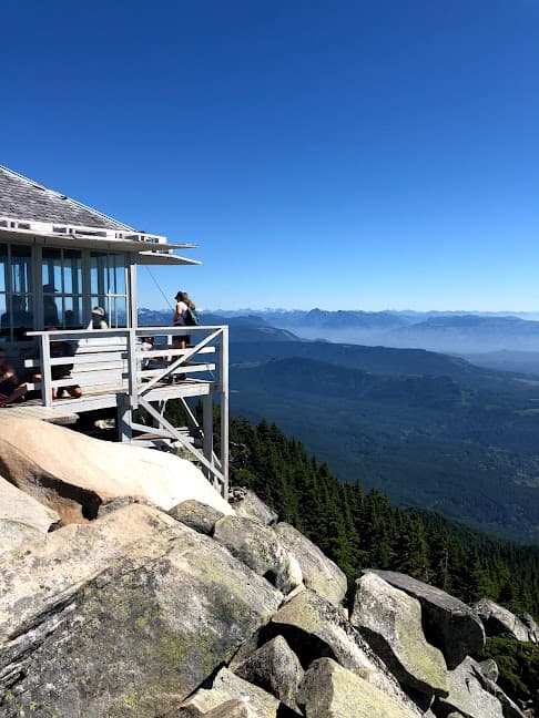
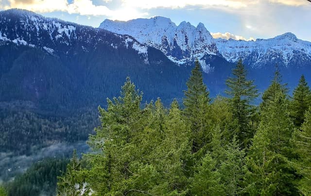
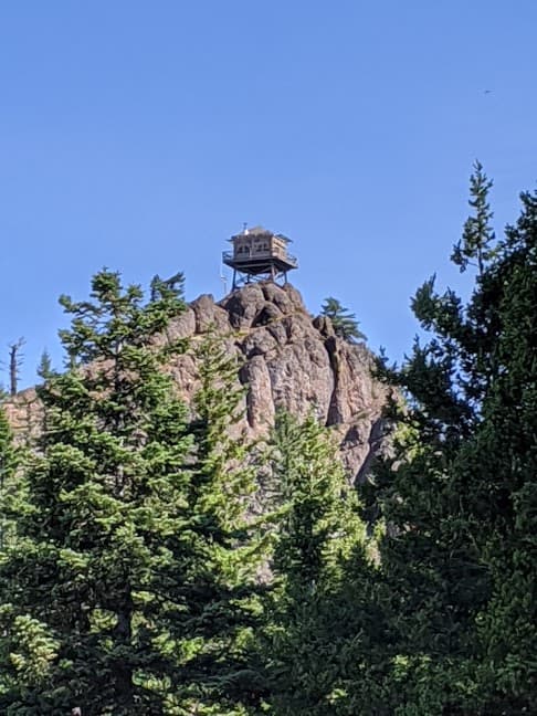
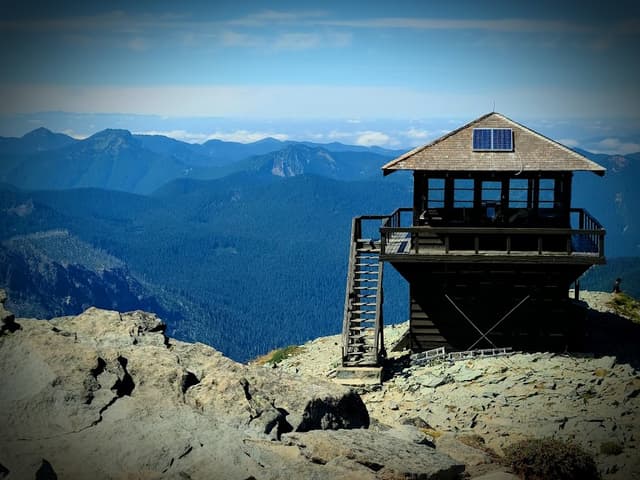
Mount Pilchuck Trailhead
@Charles
Mount Pilchuck Trailhead, NF-4200, Granite Falls
With its proximity to Seattle and short (but still challenging) trek, Mount Pilchuck is a popular fire lookout hike for good reason. The 5.4-mile round-trip hike travels through old-growth forest before reaching a boulder field that eventually leads to a fun scramble to the fire tower. The easy access means that you’ll likely have plenty of company, and at just over an hour’s drive from Seattle, it’s a doable after-work summer hike. The fire tower is first come, first served, but given its popularity, staying a night is not an easy ticket!
Details
Heybrook Lookout Trailhead
@Charles
Heybrook Lookout Trailhead, Stevens Pass Highway, Gold Bar
This beginner-friendly hike is just 1.3 miles round-trip and is located just off Highway 2, which means there are no forest service roads to navigate. The trail to Heybrook Lookout has some decent elevation gain at 850 feet, but is a peaceful walk through the woods before arriving at the fire tower. Those with a fear of heights may wish to enjoy the view from the picnic table, but the views from the top are worth the climb: full sights of Mount Baring and Mount Persis.
Details
SNOQUALMIE PASS
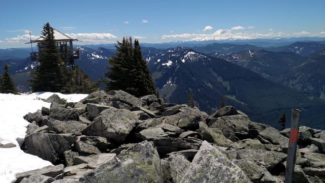
Granite Mountain Lookout
@Charles
Granite Mountain Trailhead, NF-9034, North Bend
For a good challenge just 47 miles from Seattle, Granite Mountain is another great option for a pre- or post-work hike. The 8.6-mile out-and-back route gains 3,800 feet of elevation, so it’s no walk in the park, but the steep price delivers views of Mount Rainier and nearby Kaleetan Peak. Bring plenty of food and water and take your time tackling this summit. This popular route is best hiked during the summer months, as the trail crosses a large avalanche chute. If you hike during snow season, mountaineering skills are required. As with all these hikes, especially during shoulder season, check conditions before you go.
Details
Red Top Lookout
@Charles
Red Top Lookout Trailhead, FS-9702, Cle Elum
One of the newer lookouts on this list, Red Top Lookout was built in 1952, restored in 1972 and is still operational today. At just 1.5 miles, this short, steep hike leads to an incredible view of the Teanaway Ridge, Stuart Range, Mount Rainier, and the Chelan and Entiat mountains. This is a great hike to do with kids. If the lookout is open, go ahead and peek inside, where you can check out the Osborne Fire Finder, a compasslike tool that helps lookout workers and volunteers determine the location of a fire.
Details
MOUNT RAINIER
Gobbler's Knob Fire Lookout
@Charles
Golden Lakes Trailhead, Westside Road, Ashford
For folks looking to leave the crowds a bit (and who don’t mind a longer hike), Gobbler’s Knob is a great option. The hike gains 2,500 feet of elevation over 11 miles and features beautiful wildflower meadows and backpacking options at Lake George, a crystal-clear alpine lake. Views from the top include most of the major Cascade peaks, including Rainier, plus Mount Hood, Mount St. Helens and the Olympics. Westside Road, which leads to the Golden Lakes Trailhead, closes in the winter.
Details
Mt. Fremont Fire Lookout
@Charles
Sourdough Ridge Trail, Sunrise Park Road, Ashford
This iconic Mount Rainier hike to the Fremont Lookout is a 5.6-mile round-trip adventure, with 1,200 feet of elevation gain and expansive views of the state’s tallest peak for nearly the entire hike. From the fire tower, take in the views of nearby peaks and the Olympic Mountains. With its easy access and large parking lot, the fire tower hike also draws large crowds. If you prefer some quieter hiking, aim for a weekday jaunt or plan for an offseason hike.
Details
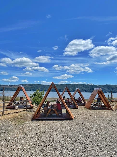
A change at Tacoma’s Point Defiance Park means a new haven for walkers and cyclists
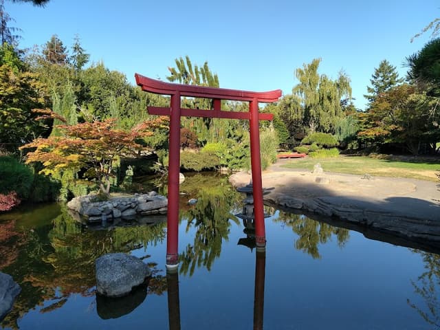
Japanese Garden at Point Defiance Park
@Charles
Details
Details
Details
Details
5 Late Summer Hikes near Glacier Peaks
Goat Lake Trailhead / Elliott Creek
@Charles
High point: 3,161 feet
Elevation gain: 1,280 feet
Round-trip distance: 10 miles
This hike’s suitable for old goats as well as kids. Pay no attention to the mileage. The elevation gain is mild.
Cruising down the twisting trail, take in the beautiful scenery, including tumbling Elliott Creek; mammoth, old-growth cedar trees; and decomposing stumps still bearing the marks of notches for springboards that held loggers to cut trees with crosscut saws.
The first portion of the lower trail follows a gentle incline along Elliott Creek, then flattens out for a long stretch along an abandoned wagon road. At the 4.5-mile mark, there used to be a bridge across the creek to an old mining settlement. Continue ahead up a steep climb over a tree-rooted path to the lake.
Take your time by the lakeshore, gazing out over the blue-green waters and up to 6,810-foot Foggy Peak. On a hot day, go for a swim.
Is Goat Lake the GOAT (Greatest Of All Time)? No. But there’s a reason why it’s so popular.
Details
Lost Creek Ridge Trailhead
@Charles
High point: 5,600 feet
Elevation gain: 3,800 feet
Round-trip distance (to Round Lake): 10 miles
Get lost in the beauty. Lost Creek Ridge is arguably one of the more memorable high-country trails in the Glacier Peak region. It can be a day-hike destination — quite an elevation gain for one day — or an extended backpack trip, depending on how far you want to go. Either way, prepare to climb.
A series of switchbacks over 2,500 feet of vertical gain brings you to Bingley Gap, roughly the 3-mile mark. This is where the fun begins.
The trail continues along the ridge and through meadows and a 5,600-foot saddle overlooking Round Lake. Day-trippers can stop here for lunch. If you’re looking to camp, it’s a 500-foot descent to the lake.
Beyond, the possibilities are endless. Ridge-runners looking for more adventure will continue to Sunup Lake and Hardtack Lake. The rough, up-and-down trail continues all the way to beautiful Lake Byrne. If you reach this point, you’re looking at a round-trip distance of 24 miles.
Details
Monte Cristo Trailhead
@Charles
High point: 2,800 feet
Elevation gain: 700 feet
Round-trip distance: 8 miles
Whether you’re a history buff or you just want a hike that’s not too challenging, you can’t go wrong exploring this historical mining town.
Even the starting point is easy to reach. The trailhead and parking lot are where the pavement of the Mountain Loop Highway ends, at Barlow Pass. The trail follows a route taken by miners more than a century ago, and more recently, a gravel road that has been closed for decades.
At the 4-mile mark, a pedestrian bridge over the Sauk River marks the entrance to the old town that was teeming with activity in the early 1900s. Explore remnants of an old railway turntable and foundations for what used to hold hotels, a powerhouse, an ore-processing plant and weatherworn, ancient-looking wood buildings in various stages of collapse.
Details
Lake Twenty-Two Trailhead
@Charles
High point: 2,400 feet
Elevation gain: 1,350 feet
Round-trip distance: 5.4 miles
Nestled on the northern shoulder of Mount Pilchuck, this relatively short hike to Lake 22 with the curious name offers a nice blend of wetlands, old-growth forest and mountain views.
A little past the halfway mark, the trail leaves the forest and climbs a talus slope, offering views of Whitehorse Mountain and Three Fingers. Cross the bridge over the outlet, and you’ve arrived.
Take a deep breath and admire the waterfalls streaming down Pilchuck’s face.
Details
Mount Pilchuck Trailhead
@Charles
Mount Pilchuck Trailhead, NF-4200, Granite Falls
With its proximity to Seattle and short (but still challenging) trek, Mount Pilchuck is a popular fire lookout hike for good reason. The 5.4-mile round-trip hike travels through old-growth forest before reaching a boulder field that eventually leads to a fun scramble to the fire tower. The easy access means that you’ll likely have plenty of company, and at just over an hour’s drive from Seattle, it’s a doable after-work summer hike. The fire tower is first come, first served, but given its popularity, staying a night is not an easy ticket!
Details
* * *